
Mapa topográfico St Stephen
Mapa interativo
Clique no mapa para exibir a altitude.
Sobre este mapa
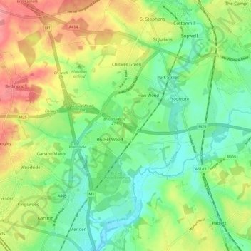
Nome: Mapa topográfico St Stephen, altitude, relevo.
Altitude média: 90 m
Altitude mínima: 55 m
Altitude máxima: 144 m
Outros mapas topográficos
Clique em um mapa para visualizar sua topografia, sua altitude e seu relevo.
Hatching Green
United Kingdom > England > St Albans > Hatching Green
Hatching Green, St Albans, Hertfordshire, East of England, England, AL5 2JS, United Kingdom
Altitude média: 119 m
River Ver
United Kingdom > England > St Albans
River Ver, St Albans, Hertfordshire, East of England, England, AL1 2HE, United Kingdom
Altitude média: 85 m
St Michael
United Kingdom > England > St Albans
St Michael, St Albans, Hertfordshire, East of England, England, United Kingdom
Altitude média: 118 m