
Obrigado por apoiar este site ❤️
Faça uma doação
Faça uma doação
Mapa topográfico Cintruénigo
Clique no mapa para exibir a altitude.
Obrigado por apoiar este site ❤️
Faça uma doação
Faça uma doação
Cintruénigo
The village of Cintruénigo is situated in the autonomous community of Navarre within the Ribera de Navarra at an altitude of 391 MSL. Its area is of 35.4 km2 and limits to the north and northeast with the municipality of Corella, to the east and south with that of Tudela and to the west with that of Fitero.
Obrigado por apoiar este site ❤️
Faça uma doação
Faça uma doação
Sobre este mapa
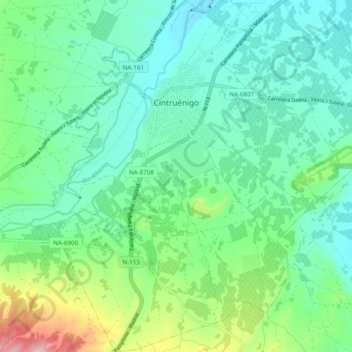
Nome: Mapa topográfico Cintruénigo, altitude, relevo.
Local: Cintruénigo, Erribera / Ribera, 31592, Spain (42.02904 -1.83733 42.10075 -1.74355)
Altitude média: 427 m
Altitude mínima: 362 m
Altitude máxima: 628 m
Obrigado por apoiar este site ❤️
Faça uma doação
Faça uma doação