
Mapa topográfico Cortez
Clique no mapa para exibir a altitude.
Cortez
Cortez has a dry-summer continental climate (Köppen Dsb), though it borders on a semi-arid climate (BSk) due to low precipitation. The city has hot summer days and cold winter nights, the latter a result of its elevation.
Sobre este mapa
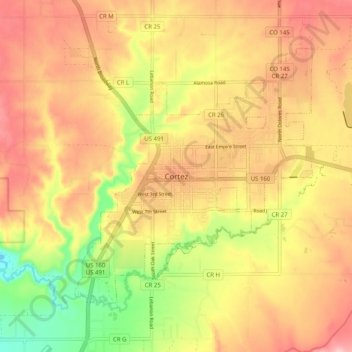
Nome: Mapa topográfico Cortez, altitude, relevo.
Altitude média: 1.869 m
Altitude mínima: 1.770 m
Altitude máxima: 1.940 m