
Obrigado por apoiar este site ❤️
Faça uma doação
Faça uma doação
Mapa topográfico The Green
Clique no mapa para exibir a altitude.
Obrigado por apoiar este site ❤️
Faça uma doação
Faça uma doação
Sobre este mapa
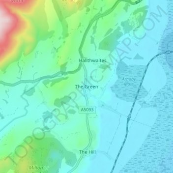
Nome: Mapa topográfico The Green, altitude, relevo.
Local: The Green, Cumberland, England, LA18 5HL, United Kingdom (54.23204 -3.28198 54.27204 -3.24198)
Altitude média: 64 m
Altitude mínima: 0 m
Altitude máxima: 380 m
Obrigado por apoiar este site ❤️
Faça uma doação
Faça uma doação
Outros mapas topográficos
Clique em um mapa para visualizar sua topografia, sua altitude e seu relevo.