
Mapa topográfico Inverkeithing
Clique no mapa para exibir a altitude.
Inverkeithing
Topographically, Inverkeithing is situated on a raised terrace sloping down towards Inverkeithing Bay, which cuts in to the south of the town, separating it from the North Queensferry peninsula. Its medieval centre lay along High Street and Church Street, but the town has since expanded to encompass areas to the north, east, and west. The Keithing Burn flows from forest plantations to the northeast of the town past the railway junction, before falling into the Inner Bay of Inverkeithing Bay 1⁄4 mi (400 m) south of the town centre.
Sobre este mapa
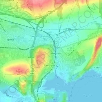
Nome: Mapa topográfico Inverkeithing, altitude, relevo.
Local: Inverkeithing, Fife, Scotland, United Kingdom (56.01937 -3.40889 56.05128 -3.36979)
Altitude média: 28 m
Altitude mínima: -5 m
Altitude máxima: 91 m
Outros mapas topográficos
Clique em um mapa para visualizar sua topografia, sua altitude e seu relevo.
Kirkcaldy
United Kingdom > Scotland > Fife
Towards the end of the 16th century, a detailed assessment on the size of the townscape was carried out. The first estimate of the parish population in 1639 was between 3,000 and 3,200 and around 3,400 by 1691. At the beginning of the 18th century, the population declined. A census by Webster's Topographical…
Altitude média: 50 m