
Mapa topográfico Grou
Mapa interativo
Clique no mapa para exibir a altitude.
Sobre este mapa
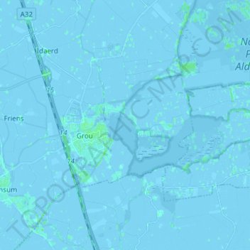
Nome: Mapa topográfico Grou, altitude, relevo.
Local: Grou, Leeuwarden, Frisia, Netherlands (53.06659 5.79330 53.12693 5.91646)
Altitude média: 0 m
Altitude mínima: -6 m
Altitude máxima: 4 m
Outros mapas topográficos
Clique em um mapa para visualizar sua topografia, sua altitude e seu relevo.
Vierhuizen
Netherlands > Frisia > Allingawier
Vierhuizen, Allingawier, Súdwest-Fryslân, Frisia, Netherlands, 8758 LG, Netherlands
Altitude média: -2 m
Surhuisterveen
Surhuisterveen, Achtkarspelen, Frisia, Netherlands
Altitude média: 3 m
West Frisian Islands
West Frisian Islands, Frisia, Netherlands
Altitude média: 1 m
Oosterstreek
Oosterstreek, Weststellingwerf, Frisia, Netherlands
Altitude média: 4 m
Noardburgum
Netherlands > Frisia > Noardburgum
Noardburgum, Tytsjerksteradiel, Frisia, Netherlands
Altitude média: 1 m
Leeuwarden
Netherlands > Frisia > Leeuwarden
Leeuwarden, Frisia, Netherlands, 8911BR, Netherlands
Altitude média: 0 m