
Mapa topográfico Liberal
Mapa interativo
Clique no mapa para exibir a altitude.
Sobre este mapa
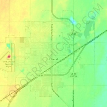
Nome: Mapa topográfico Liberal, altitude, relevo.
Local: Liberal, Seward County, Kansas, 67905, United States (37.01741 -100.97644 37.07726 -100.88633)
Altitude média: 867 m
Altitude mínima: 840 m
Altitude máxima: 900 m
Liberal is located at 37°2′36″N 100°55′41″W / 37.04333°N 100.92806°W / 37.04333; -100.92806 (37.043418, −100.928133) at an elevation of 2,835 feet (864 m).[7] Located in southwestern Kansas at the intersection of U.S. Route 83 and U.S. Route 54, Liberal is 140 miles (225 km) north-northeast of Amarillo, Texas, 202 mi (325 km) west-southwest of Wichita, and 288 mi (463 km) southeast of Denver, Colorado.[8][9]