
Mapa topográfico Hemington
Mapa interativo
Clique no mapa para exibir a altitude.
Sobre este mapa
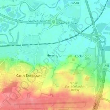
Nome: Mapa topográfico Hemington, altitude, relevo.
Altitude média: 51 m
Altitude mínima: 26 m
Altitude máxima: 98 m
Outros mapas topográficos
Clique em um mapa para visualizar sua topografia, sua altitude e seu relevo.
Ashby-de-la-Zouch
United Kingdom > England > Leicestershire > North West Leicestershire > Ashby-de-la-Zouch
Ashby-de-la-Zouch, North West Leicestershire, Leicestershire, East Midlands, England, United Kingdom
Altitude média: 132 m
Coalville
United Kingdom > England > Leicestershire > North West Leicestershire
Coalville, North West Leicestershire, Leicestershire, England, LE67 3DW, United Kingdom
Altitude média: 149 m