
Mapa topográfico Seneca
Mapa interativo
Clique no mapa para exibir a altitude.
Seneca
Seneca is located close to the intersection of River Road (Maryland Route 190), Seneca Road (Maryland route 112), and Rileys Lock Road, east of Great Seneca Creek and north of the Potomac River. The C&O Canal runs along the river, and Riley's Lock is the closest canal lock. The southern portion of Seneca Creek State Park is nearby, as is the Bretton Woods Golf Course. The United States Geological Survey (USGS) lists the community's elevation as 187 feet (57 meters).
Sobre este mapa
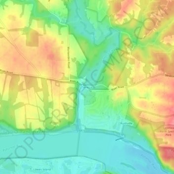
Nome: Mapa topográfico Seneca, altitude, relevo.
Altitude média: 82 m
Altitude mínima: 48 m
Altitude máxima: 122 m