
Faça uma doação
Mapa topográfico Isla Guadalupe
Clique no mapa para exibir a altitude.
Faça uma doação
Isla Guadalupe
Campo Pista is located at the small airport, near the center of the island (29°01′24.04″N 118°16′21.75″W / 29.0233444°N 118.2727083°W / 29.0233444; -118.2727083, elevation:592 m, direction:05/23).[1] Airport Isla Guadalupe (ICAO Code MMGD) has a 1,200-metre-long (3,900 ft) runway. At the end of the runway near threshold 5 is the wreckage of a Lockheed Model 18 Lodestar, which overshot the runway during landing. A North American B-25J-30/32 Mitchell, BMM-3501 (c/n 44-86712), bomber wrecked on the opposite end of the runway, after suffering serious damage in trying to take-off overloaded (29°01′36.10″N 118°16′2.98″W / 29.0266944°N 118.2674944°W / 29.0266944; -118.2674944). Based on historical Google Earth imagery, this B-25 wreckage appears to have been removed from the location between October, 2005, and June, 2006.
Faça uma doação
Sobre este mapa
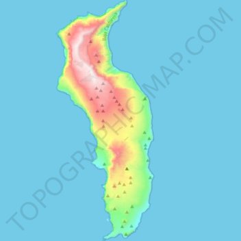
Nome: Mapa topográfico Isla Guadalupe, altitude, relevo.
Altitude média: 113 m
Altitude mínima: 0 m
Altitude máxima: 1.284 m
Faça uma doação
Outros mapas topográficos
Clique em um mapa para visualizar sua topografia, sua altitude e seu relevo.
Ejido El Porvenir
Mexico > Baja California > Municipio de Ensenada
The valley slopes gently from northeast to southwest with an average elevation of 344 metres (1,129 ft) above sea level. The margins of the plain are composed of alluvial fans and colluvium of reddish soil from the surrounding hillsides. Chaparral grows along the rocky slopes and live oak trees can be found in…
Altitude média: 317 m
Laguna de Santo Tomás
Mexico > Baja California > Municipio de Ensenada > La Bocana
Altitude média: 40 m
Faça uma doação
Parque Nacional Sierra de San Pedro Mártir
Mexico > Baja California > Municipio de Ensenada
Sierra de San Pedro Mártir National Park was officially created by decree on April 26, 1947, in which 72,909 hectares were set aside and declared protected by the Mexican Federal government. The National Astronomical Observatory is located at an elevation of 2,830 m (9,280 ft). The observatory was built in…
Altitude média: 1.463 m
Francisco Zarco (Valle de Guadalupe)
Mexico > Baja California > Municipio de Ensenada
Altitude média: 384 m
Faça uma doação