
Obrigado por apoiar este site ❤️
Faça uma doação
Faça uma doação
Mapa topográfico Dalbury
Clique no mapa para exibir a altitude.
Obrigado por apoiar este site ❤️
Faça uma doação
Faça uma doação
Sobre este mapa
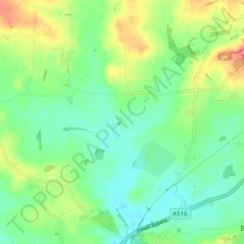
Nome: Mapa topográfico Dalbury, altitude, relevo.
Altitude média: 76 m
Altitude mínima: 55 m
Altitude máxima: 112 m
Obrigado por apoiar este site ❤️
Faça uma doação
Faça uma doação
Outros mapas topográficos
Clique em um mapa para visualizar sua topografia, sua altitude e seu relevo.
Cooper's Lake
United Kingdom > England > Derbyshire > South Derbyshire > Weston-on-Trent
Altitude média: 47 m
Willington CP
United Kingdom > England > Derbyshire > South Derbyshire > Willington CP
Altitude média: 51 m