
Faça uma doação
Mapa topográfico Florida City
Clique no mapa para exibir a altitude.
Faça uma doação
Florida City
Florida City is situated mostly atop a limestone ridge called the Miami Rock Ridge that extends south from present day North Miami Beach to a location in Everglades National Park. The ridge, consisting of Miami limestone, serves as the higher ground within the community. The ridge extended from northeast to southwest across the city. The old location of the Florida East Coast Railway track marks the approximate boundary of the location of the limestone ridge south of Davis Parkway. The range of elevation of the ridge is from 5 to 8 feet (1.5–2.4 meters) above sea level.
Faça uma doação
Sobre este mapa
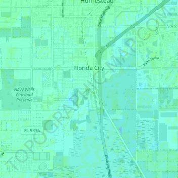
Nome: Mapa topográfico Florida City, altitude, relevo.
Altitude média: 3 m
Altitude mínima: 0 m
Altitude máxima: 8 m
Faça uma doação
Outros mapas topográficos
Clique em um mapa para visualizar sua topografia, sua altitude e seu relevo.
Faça uma doação
Faça uma doação
Alice C Wainwright Park
United States > Florida > Miami-Dade County > Miami > Brickell Hammock
Altitude média: 6 m
Faça uma doação
Faça uma doação
Faça uma doação
Miami
United States > Florida > Miami-Dade County
Miami and its suburbs are located on a broad plain between the Everglades to the west and Biscayne Bay to the east, which extends from Lake Okeechobee southward to Florida Bay. The elevation of the area averages at around 6 ft (1.8 m) above sea level in most neighborhoods, especially near the coast. The…
Altitude média: 4 m
Faça uma doação
Faça uma doação
Faça uma doação
Faça uma doação
Faça uma doação
Sun-Tan Village
United States > Florida > Miami-Dade County > Hialeah > Sun-Tan Village
Altitude média: 7 m
Tamiami
United States > Florida > Miami-Dade County > University Lakes Mobile Home Park
Altitude média: 6 m
Faça uma doação
Burke Recreation Center
United States > Florida > Miami-Dade County > Biscayne Park
Altitude média: 9 m
Pops Hammock Seminole Village
United States > Florida > Miami-Dade County > Pops Hammock Seminole Village
Altitude média: 3 m
Faça uma doação
Hawley Heights
United States > Florida > Miami-Dade County > Kendall > Hawley Heights
Altitude média: 7 m
Faça uma doação
Miami Heights Trailer Park
United States > Florida > Miami-Dade County > Miami Heights Trailer Park
Altitude média: 7 m
South Miami Heights
United States > Florida > Miami-Dade County > South Miami Heights
Altitude média: 6 m
Faça uma doação
Faça uma doação