
Mapa topográfico Ob River
Mapa interativo
Clique no mapa para exibir a altitude.
Sobre este mapa
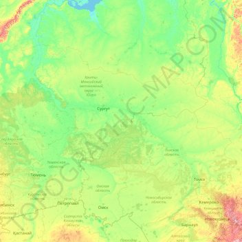
Nome: Mapa topográfico Ob River, altitude, relevo.
Altitude média: 122 m
Altitude mínima: -1 m
Altitude máxima: 2.033 m
The combined Ob-Irtysh system, the fourth-longest river system of Asia (after Yenisei, and China's Yangzi and Yellow rivers), is 5,410 kilometres (3,360 mi) long, and the area of its basin 2,990,000 square kilometres (1,150,000 sq mi). The river basin of the Ob consists mostly of steppe, taiga, swamps, tundra, and semi-desert topography. The floodplains of the Ob are characterized by many tributaries and lakes. The Ob is ice-bound at southern Barnaul from early in November to near the end of April, and at northern Salekhard, 150 km (93 mi) above its mouth, from the end of October to the beginning of June. The Ob River crosses several climatic zones. The upper Ob valley, in the south, grows grapes, melons and watermelons, whereas the lower reaches of the Ob are Arctic tundra. The most comfortable climate for the rest on the Ob are Biysk, Barnaul, and Novosibirsk.