Geolocalizar

Mapa topográfico Loboc River

Mapa interativo

Clique no mapa para exibir a altitude.

Sobre este mapa

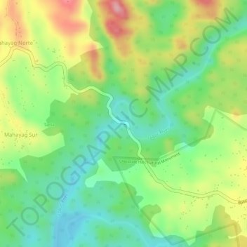
Nome: Mapa topográfico Loboc River, altitude, relevo.

Local: Loboc River, Tagbilaran, Bohol, Central Visayas, Philippines (9.81676 124.07491 9.81683 124.07492)

Altitude média: 199 m

Altitude mínima: 129 m

Altitude máxima: 289 m

Outros mapas topográficos

Clique em um mapa para visualizar sua topografia, sua altitude e seu relevo.

Loboc River

Philippines > Bohol > Tagbilaran

Loboc River, Tagbilaran, Bohol, Central Visayas, 6316, Philippines

Altitude média: 28 m

Cancostino Island

Philippines > Bohol > Tagbilaran

Cancostino Island, Tagbilaran, Bohol, Central Visayas, 6329, Philippines

Altitude média: 89 m

Cabgan Islet

Philippines > Bohol > Tagbilaran

Cabgan Islet, Tagbilaran, Bohol, Central Visayas, 6329, Philippines

Altitude média: 90 m

Cabilao Island

Philippines > Bohol > Tagbilaran

Cabilao Island, Tagbilaran, Bohol, Central Visayas, Philippines

Altitude média: 6 m

Catang Island

Philippines > Bohol > Tagbilaran

Catang Island, Tagbilaran, Bohol, Central Visayas, Philippines

Altitude média: 79 m

Mantatao Island

Philippines > Bohol > Tagbilaran

Mantatao Island, Tagbilaran, Bohol, Central Visayas, Philippines

Altitude média: 0 m

Silo Island

Philippines > Bohol > Tagbilaran

Silo Island, Tagbilaran, Bohol, Central Visayas, 6330, Philippines

Altitude média: 90 m

Sandingan Island

Philippines > Bohol > Tagbilaran

Sandingan Island, Tagbilaran, Bohol, Central Visayas, Philippines

Altitude média: 10 m