
Mapa topográfico Narni
Mapa interativo
Clique no mapa para exibir a altitude.
Narni
Narni (Latin: Narnia) is an ancient hilltown and comune of Umbria, in central Italy, with 19,252 inhabitants (2017). At an altitude of 240 metres (790 ft), it overhangs a narrow gorge of the Nera River in the province of Terni. It is very close to the geographic center of Italy. There is a stone on the exact spot with a sign in multiple languages.
Sobre este mapa
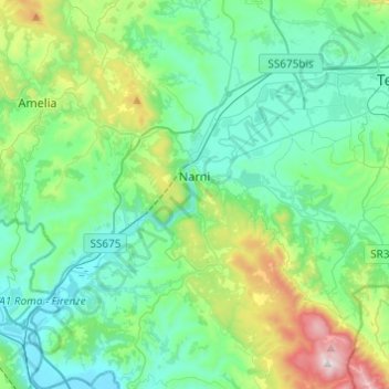
Nome: Mapa topográfico Narni, altitude, relevo.
Local: Narni, Terni, Umbria, 05035, Italy (42.42158 12.41137 42.60082 12.61466)
Altitude média: 250 m
Altitude mínima: 42 m
Altitude máxima: 1.017 m
Outros mapas topográficos
Clique em um mapa para visualizar sua topografia, sua altitude e seu relevo.