Mapa topográfico Tucson
Clique no mapa para exibir a altitude.
Tucson
The city's elevation is 2,643 ft (806 m) above sea level (as measured at the Tucson International Airport). Tucson is on an alluvial plain in the Sonoran Desert, surrounded by five minor ranges of mountains: the Santa Catalina Mountains and the Tortolita Mountains to the north, the Santa Rita Mountains to the south, the Rincon Mountains to the east, and the Tucson Mountains to the west. The high point of the Santa Catalina Mountains is 9,157 ft (2,791 m) Mount Lemmon, the southernmost ski destination in the continental U.S., while the Tucson Mountains include 4,687 ft (1,429 m) Wasson Peak. The highest point in the area is Mount Wrightson, found in the Santa Rita Mountains at 9,453 ft (2,881 m) above sea level.
Sobre este mapa
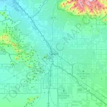
Nome: Mapa topográfico Tucson, altitude, relevo.
Local: Tucson, Pima County, Arizona, 85701, United States (32.06288 -111.13485 32.38288 -110.81485)
Altitude média: 836 m
Altitude mínima: 634 m
Altitude máxima: 2.313 m
Outros mapas topográficos
Clique em um mapa para visualizar sua topografia, sua altitude e seu relevo.