
Faça uma doação
Mapa topográfico Burtons Bridge
Clique no mapa para exibir a altitude.
Faça uma doação
Sobre este mapa
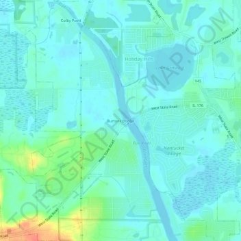
Nome: Mapa topográfico Burtons Bridge, altitude, relevo.
Altitude média: 231 m
Altitude mínima: 221 m
Altitude máxima: 269 m
Faça uma doação
Outros mapas topográficos
Clique em um mapa para visualizar sua topografia, sua altitude e seu relevo.
Faça uma doação
McHenry
United States > Illinois > McHenry County
It rests at an elevation of 797 feet and the Fox River flows through the eastern portion of the city. It is surrounded by natural lakes and streams, grassy moraine hills, gravel banks and shallow nutrient-rich peat bogs, remnants of receding glaciers from the last ice age. Moraine Hills State Park, Glacial…
Altitude média: 237 m
Faça uma doação
Faça uma doação
Faça uma doação
Faça uma doação
Faça uma doação
Faça uma doação