
Faça uma doação
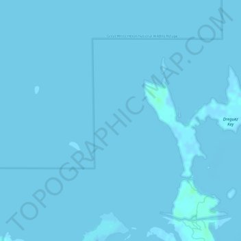
Mapa topográfico Florida Keys
Clique no mapa para exibir a altitude.
Faça uma doação
Florida Keys
The Florida Keys, an archipelago extending about 120 miles from the southeastern tip of Florida, feature a unique topography characterized by low-lying coral islands and a series of intricate waterways. Most islands are less than 5 feet above sea level, contributing to their vulnerability to storm surges and flooding during hurricanes. The Keys are primarily formed of limestone, shaped over thousands of years through coral growth and erosion, and are punctuated by areas of mangroves and sandy beaches. The terrain is often described as flat and delicate, with numerous small islands connected by a network of bridges, including the notable Seven Mile Bridge. This geographical layout not only enhances the natural beauty of the region but also creates a rich habitat for diverse marine life, making the Florida Keys a vital ecological zone.
Faça uma doação
Sobre este mapa
Nome: Mapa topográfico Florida Keys, altitude, relevo.
Local: Florida Keys, Monroe County, Florida, United States (24.66704 -81.58319 24.66714 -81.58309)
Altitude média: 0 m
Altitude mínima: -2 m
Altitude máxima: 5 m
Faça uma doação
Outros mapas topográficos
Clique em um mapa para visualizar sua topografia, sua altitude e seu relevo.
Faça uma doação
Faça uma doação
Faça uma doação
Faça uma doação