
Mapa topográfico Thousand Oaks
Mapa interativo
Clique no mapa para exibir a altitude.
Sobre este mapa
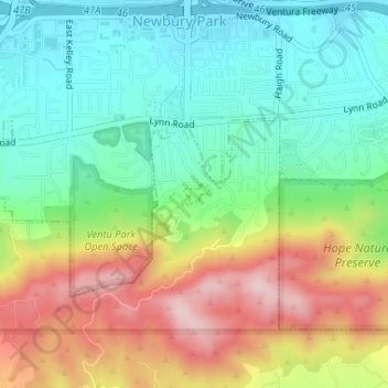
Nome: Mapa topográfico Thousand Oaks, altitude, relevo.
Altitude média: 303 m
Altitude mínima: 191 m
Altitude máxima: 486 m
The northern parts consist of mountainous terrain in the Simi Hills, Conejo Mountains and Mount Clef Ridge. Narrow canyons such as Hill Canyon cut through the steeper mountainous areas. Conejo Mountain and Conejo Grade are found in westernmost Newbury Park, while the southernmost parts of Thousand Oaks are made up of Russell Valley, Hidden Valley and the steep rugged slopes of the Santa Monica Mountains. The elevation ranges from 500 feet in the northwest to the 2,403 feet Simi Peak. The major drainage is Conejo Creek (Arroyo Conejo).