
Mapa topográfico Lawrence
Mapa interativo
Clique no mapa para exibir a altitude.
Lawrence
Downtown Lawrence is located at 38°58′18″N 95°14′7″W / 38.97167°N 95.23528°W / 38.97167; -95.23528 (38.959902, −95.253199), approximately 25 miles (40 kilometers) east of Topeka, and 35 mi (56 km) west of Kansas City, Kansas. Though Lawrence has a designated elevation of 866 feet (264 m), the highest elevation is Mount Oread on the University of Kansas campus with an elevation of 1,020 feet (310 m).
Sobre este mapa
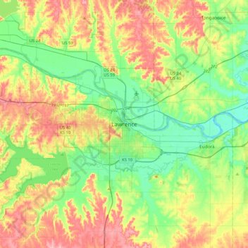
Nome: Mapa topográfico Lawrence, altitude, relevo.
Local: Lawrence, Douglas County, Kansas, 66044, United States (38.81194 -95.39595 39.13194 -95.07595)
Altitude média: 283 m
Altitude mínima: 237 m
Altitude máxima: 353 m
Outros mapas topográficos
Clique em um mapa para visualizar sua topografia, sua altitude e seu relevo.