
Obrigado por apoiar este site ❤️
Faça uma doação
Faça uma doação
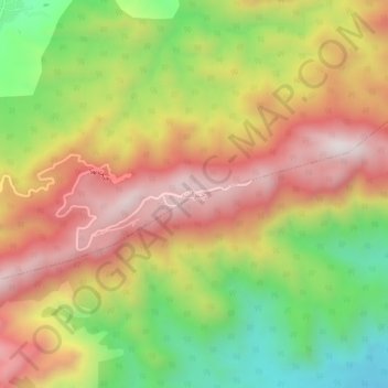
Mapa topográfico Cherat
Clique no mapa para exibir a altitude.
Obrigado por apoiar este site ❤️
Faça uma doação
Faça uma doação
Cherat
Cherat (Pashto: چېراټ) is a hill station dating from the 1860s that is located immediately above the villages of Chapri,Bakhti, Saleh Khana, Kotli Kalan and Dak Ismail Khel in the Nowshera District of Khyber-Pakhtunkhwa in Pakistan. Cherat lies 34 miles south east from the city of Peshawar at an elevation of 4,500 feet on the west of the Khattak range, which divides the district of Nowshera from Kohat District.
Obrigado por apoiar este site ❤️
Faça uma doação
Faça uma doação
Sobre este mapa
Nome: Mapa topográfico Cherat, altitude, relevo.
Altitude média: 986 m
Altitude mínima: 553 m
Altitude máxima: 1.380 m
Obrigado por apoiar este site ❤️
Faça uma doação
Faça uma doação