
Obrigado por apoiar este site ❤️
Faça uma doação
Faça uma doação
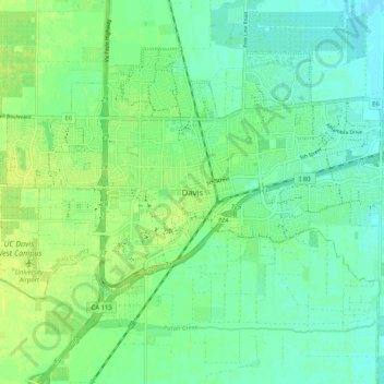
Mapa topográfico Davis
Clique no mapa para exibir a altitude.
Obrigado por apoiar este site ❤️
Faça uma doação
Faça uma doação
Davis
Davis lies in the Sacramento Valley, the northern portion of the Central Valley, in Northern California, at an elevation of about 52 feet (16 m) above sea level.
Obrigado por apoiar este site ❤️
Faça uma doação
Faça uma doação
Sobre este mapa
Nome: Mapa topográfico Davis, altitude, relevo.
Local: Davis, Yolo County, California, 95616, United States (38.50538 -121.78458 38.58538 -121.70458)
Altitude média: 15 m
Altitude mínima: 7 m
Altitude máxima: 23 m
Obrigado por apoiar este site ❤️
Faça uma doação
Faça uma doação