
Obrigado por apoiar este site ❤️
Faça uma doação
Faça uma doação
Mapa topográfico Hartlebury Common Local Nature Reserve
Clique no mapa para exibir a altitude.
Obrigado por apoiar este site ❤️
Faça uma doação
Faça uma doação
Sobre este mapa
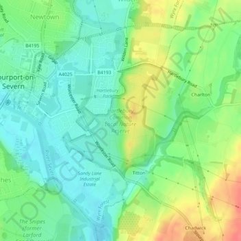
Nome: Mapa topográfico Hartlebury Common Local Nature Reserve, altitude, relevo.
Altitude média: 39 m
Altitude mínima: 16 m
Altitude máxima: 79 m
Obrigado por apoiar este site ❤️
Faça uma doação
Faça uma doação