
Mapa topográfico Rathcairn
Clique no mapa para exibir a altitude.
Sobre este mapa
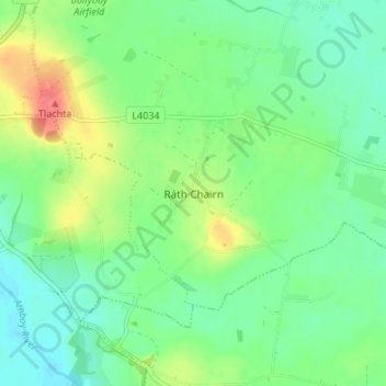
Nome: Mapa topográfico Rathcairn, altitude, relevo.
Altitude média: 77 m
Altitude mínima: 58 m
Altitude máxima: 113 m
Outros mapas topográficos
Clique em um mapa para visualizar sua topografia, sua altitude e seu relevo.
Julianstown
Julianstown was the seat of the Moore family who lived in Julianstown House and occupied the land that now contains the townland of Julianstown West. Taylor and Skinner's 1783 Road Map of Ireland refers to the Moore seat and also shows the Church of Ireland church which still stands today. There is little…
Altitude média: 20 m