
Mapa topográfico Seyboldsdorf
Mapa interativo
Clique no mapa para exibir a altitude.
Sobre este mapa
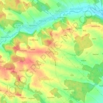
Nome: Mapa topográfico Seyboldsdorf, altitude, relevo.
Altitude média: 470 m
Altitude mínima: 435 m
Altitude máxima: 504 m
Seyboldsdorf ist ein nördlich gelegener Gemeindeteil der Stadt Vilsbiburg im niederbayerischen Landkreis Landshut. Seyboldsdorf liegt auf einem Höhenrücken im Isar-Inn-Hügelland zwischen Großer und Kleiner Vils.