
Mapa topográfico 临沧市
Mapa interativo
Clique no mapa para exibir a altitude.
Sobre este mapa
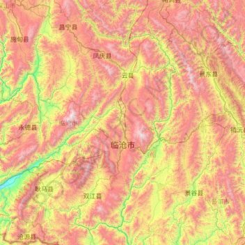
Nome: Mapa topográfico 临沧市, altitude, relevo.
Local: 临沧市, Yunnan, 665000, China (23.07996 98.67215 25.03572 100.54641)
Altitude média: 1.647 m
Altitude mínima: 479 m
Altitude máxima: 3.464 m